Restos arqueológicos
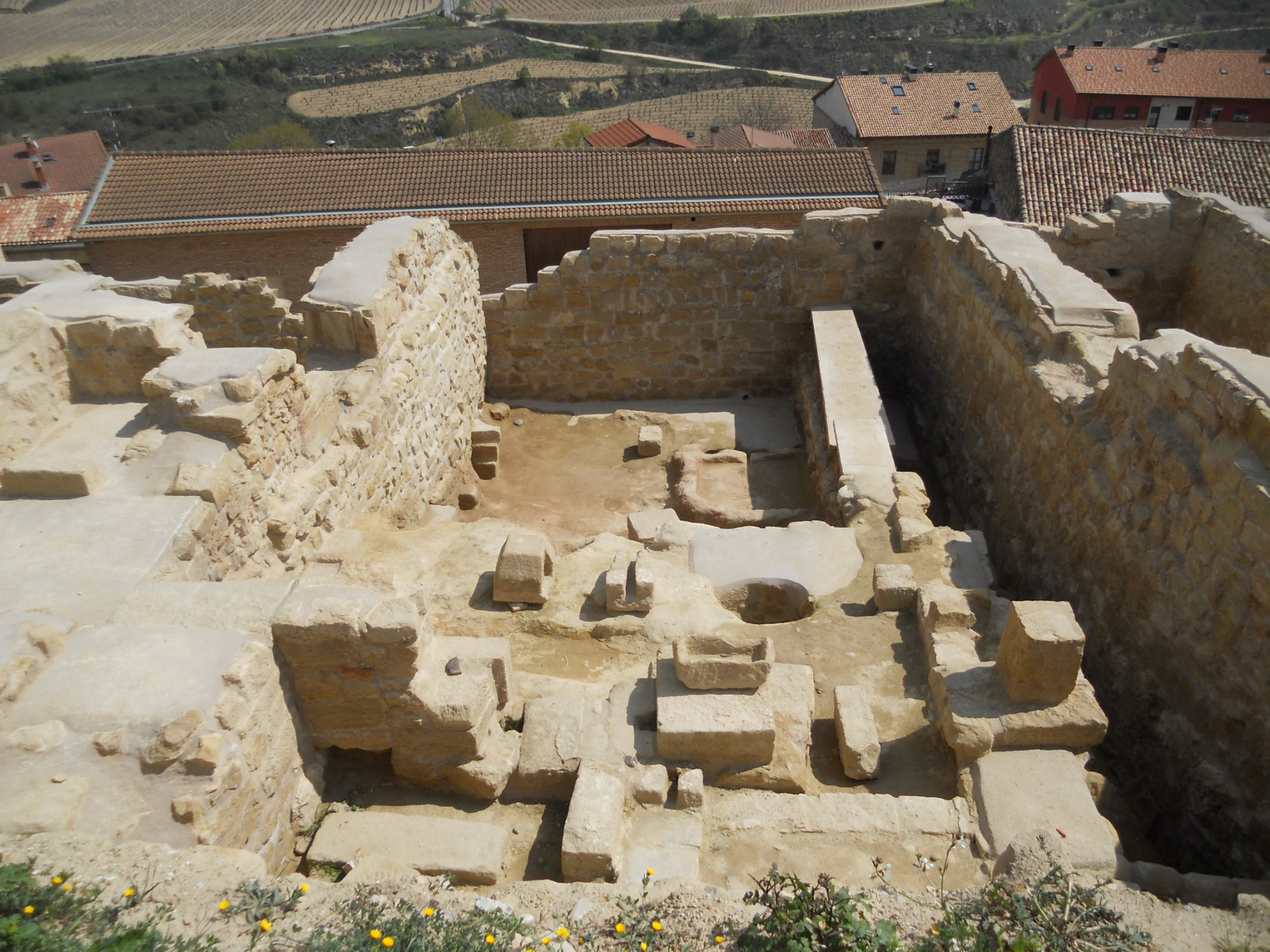
En el curso de las obras de rehabilitación ejecutadas en el recinto fortificado, se han realizado varias campañas de excavaciones arqueológicas que han sacado a la luz los restos de las ocupaciones históricas que se han sucedido en este espacio.
Durante siglos parte de los vecinos de San Vicente vivieron dentro del recinto (algunos hasta comienzos del siglo XX). Tras el hundimiento de parte de la muralla y de varias casas en diciembre de 1897, se aceleró el abandono de la zona.
Adosados a la cara interna de la muralla inferior encontramos muros y suelos correspondientes a viviendas que datan de los siglos XII y XIII, restos de edificios de mayores dimensiones construidos en el siglo XVI sobre las parcelas medievales e instalaciones vinícolas. Entre estas últimas destaca un calado con su bodega (abandonada a fines del siglo XIX) y una pileta para prensado de uva con su correspondiente torco tallados en la roca (similar a los numerosos lagares rupestres que proliferan en campo abierto por toda la Sonsierra, pero con el valor añadido de que aquí apareció sellada por sedimentos que se remontan a los siglos XII y XIII)
Más información
- Localización. Interior del Recinto Fortificado. Se recomienda el acceso a pie desde la calle Carnicerías a través de la puerta de la Primicia
- Coordenadas GPS 42°33'36.0"N 2°45'24.0"W // 42.560006, -2.756671
- Enlace a google maps
- Entrada libre y gratuita. No accesible minusválidos
- Casco histórico: Acceso restringido a vehículos según altura y peso. Peatonalización de la zona de la Plaza Mayor en fechas concretas. Se recomienda estacionar los vehículos fuera de la zona histórica
- Más información en este enlace
 Archeological remains
In the course of the rehabilitation works carried out in the fortified enclosure, several campaigns of archaeological excavations have been carried out that have brought to light the remains of the historical occupations that have taken place in this space.
For centuries part of the neighbors of San Vicente lived inside the enclosure (some until the beginning of the 20th century). After the collapse of part of the wall and several houses in December 1897, the abandonment of the area accelerated.
Attached to the inner face of the lower wall are walls and floors corresponding to houses dating from the 12th and 13th centuries, remains of larger buildings built in the 16th century on medieval plots and winemaking facilities. Among the latter, it is worth mentioning a draft with its winery (abandoned at the end of the 19th century) and a pool for grape pressing with its corresponding torch carved into the rock (similar to the numerous rock wineries that proliferate in the open countryside throughout the Sonsierra, but with the added value that here appeared sealed by sediments that go back to the XII and XIII centuries)
More information
- Location. Interior of the Fortified Enclosure. Access is recommended on foot from Carnicerías street through the Puerta de la Primicia
- GPS coordinates 42 ° 33'36.0 "N 2 ° 45'24.0" W // 42.560006, -2.756671
- Link to google maps
- Free and free entry. Not accessible handicapped
- Historical center: Restricted access to vehicles according to height and weight. Pedestrianization of the Plaza Mayor area on specific dates. It is recommended to park vehicles outside the historic área
- More information in this link (Spanihs)